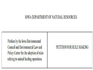
The Iowa Environmental Council and Environmental Law & Policy Center present this petition for rule making pursuant to 567 IAC 5.1 and the Uniform Rules on Agency Procedure. The petition requests revision of rules relating to the siting of animal feeding operations. The revisions requested in this petition are based on the need to protect water quality, specifically as it relates to karst topography, groundwater and drinking water sources. Read more…
I posted an essay in May describing a Water Quality Index (WQI) I developed about five years ago for Iowa DNR with Rick Langel of the Iowa Geological Survey. To summarize, we developed a single-value metric of water quality for Iowa streams [including] streams flowing through the Paleozoic Plateau of NE Iowa.
This includes the Upper Iowa, Turkey, Volga, and Yellow Rivers, and Bloody Run Creek. This is the only part of Iowa that was left untouched by glaciers over the past 100 million years. Read more…
Clayton County’s Bloody Run Creek is designated an “Outstanding Iowa Water” by the Iowa DNR because limestone geology and a modestly-undisturbed watershed support a clear, cold stream that is home to trout and other pollution-intolerant species.
All things considered, a person might expect that our government would tenaciously protect, and our industries would respect, Bloody Run Creek and the other 33 “outstanding” waters, since there is only one for every 320,000 Iowans. Yes, a reasonable person could expect that. Read more…
A variety of geologic factors have produced the karst, shallow rock, high relief landscape of northeast Iowa. These solutionally modified karst-carbonate rocks are excellent aquifers. They are capable of transmitting large quantities of groundwater at quite fast rates.
Water – and any contaminants – enter karst-carbonate aquifers via sinkholes, losing streams, and by infiltration through the shallow soils in flat upland areas. Read more…
This document reviews the geology and groundwater setting in the vicinity of a proposed Walz Energy waste lagoon located southeast of Monona. The site is located in the watershed of Bloody Run. The proposed lagoon would have a maximum liquid depth of 30 feet and a capacity volume of approximately 38 million gallons.
There is concern in vulnerable geologic settings for lagoon seepage to impact groundwater quality. Read more…